Friday, December 30, 2011

2012 Free Virginia Travel Guide

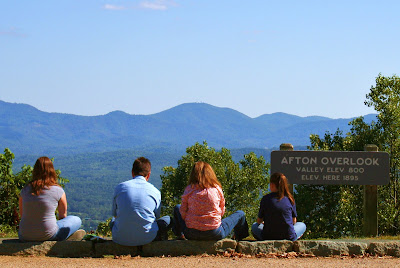
A family enjoys an overlook on the Blue Ridge Parkway

The Virginia Tourism Office is offering a free and updated travel guide for 2012 with new destinations, family favorites, and attractions “that put love at the heart of every Virginia vacation”.

New features this year include vacation ideas for all four seasons, a special section on small towns, scenic drives and a listing of the newest attractions to open in Virginia. 

The guide is full of trip inspirations and travel resources. Visitors can request a free copy of the 2012 Virginia Travel Guide in print or electronic form by going to www.Virginia.org or calling 1-800-VISITVA.

Sunday, November 20, 2011

Montpelier Races in Orange County Nov 2011

 Horses race toward the jump!
 Ruth and Ann chumming it up.
 Sara and Grandma Edith taking it all in.
Liz walks the children to get closer to the action.

Friday, October 21, 2011

Fall color grandeur in the Blue Ridge Mountains


Peak fall color has come on fast in higher elevations the past week according to Virtual Blue Ridge, a supporter of the non-profit Blue Ridge Foundation out of Boone, North Carolina, and this weekend may be the best time to see the season’s grandeur in the Blue Ridge Mountains.
The 469-mile Blue Ridge Parkway begins in Virginia at Rockfish Gap on Afton Mountain between Charlottesville and Waynesboro, Virginia, 78 miles from Richmond. Brilliant yellows, oranges, deep scarlets and reds are reported from there south to the Peaks of Otter. Points north in the Shenandoah National Park also offer stunning vistas and there is an online update on fall foliage.

On the parkway south of Roanoke down to the Blue Ridge Music Center the scenery is also in peak color.  Higher elevations like Grandfather Mountain near Boone are past peak but still have beautiful color remaining.

The Virginia Department of Forestry offers weekly updates on its website along with a "Fall Foliage Hotline" at 1-800-424-LOVE (5683) providing the latest in fall color throughout the state from the Atlantic seashore to the Appalachian Mountains. These reports are available through early November.

Virtual Blue Ridge publishes weekly fall color reports online or you can call their fall foliage hotline at 828-298-0398.

Tuesday, September 27, 2011

Fall foliage reports for Virginia and free maps


The Virginia Department of Forestry begins its fall foliage reports around September 29, 2011. The state agency will provide weekly updates on the progression of fall colors in Virginia.
Typical dates for peak season are mid-October to early November for the western mountainous region, late October to mid-November for the central and piedmont regions, and early to mid November for the eastern regions.
Free Maps
Check out Virginia.org/Fall to find the best places for scenic viewing, when the peak is nearing and other fun activities and getaways to enjoy this season.
Order a Map of Scenic Roads in Virginia to get you on your way to see beautiful Fall foliage. The map comes with a Virginia Travel Guide to help you plan your trip. You'll also receive the supplemental 150th Anniversary Civil War Map of Scenic Roads.


Monday, August 29, 2011

New Virginia fall travel planning website


The Virginia Tourism Corporation has launched a new fall travel planning website featuring destinations and events where loved ones or loners can celebrate the season.  Visitors looking to take in stunning fall foliage on a scenic drive can use http://www.Virginia.org/fall to plan the perfect trip. 
The new website features interactive mapping using GPS technology so visitors can search by zip code or locality to find the ideal fall experience.  

Monday, July 25, 2011

The wild pony roundup in Chincoteague

Ed Hagaman photo of pony and colt

Tens of thousands of people are flocking to Virginia’s Eastern Shore to watch the wild pony round-up on Assateague Island, held this Wednesday, July 27.
The Chincoteague volunteer fire department rounds up the ponies and herds them across the channel to Chincoteague Island. There some of the foals and yearlings will be auctioned off at their annual carnival before the swim back on Friday.
Made famous by the book and movie “Misty of Chincoteague,” the pony swim and auction began in 1925 when the town needed money to buy fire equipment after some devastating fires. Today it has become a national treasure and is often featured on Good Morning America.
The exact time of the swim isn’t announced more than a day in advance because of tidal conditions - the waters need to be “slack calm” to protect ponies born in the spring and early summer – but it’s generally sometime between 7 a.m. and 1 p.m.
Island Wildlife
In addition to being home to over 300 wild ponies, Assateague Island is famous for its magnificent birds, attracting birding enthusiasts worldwide to this vital resting and feeding grounds. Over 300 species of migratory or resident birds may be seen here.
One way to view the island’s wildlife is by boat – nature tours are available seven days a week between late May and early October. There are also bike and kayak rentals.
Or you can experience the wild ponies, birds, beaches and stunning sunrises and sunsets on foot. Greg Pels, past president of Richmond Camera Club, organizes photography excursions there several times a year. See his slide show of birds and beauty at http://www.examiner.com/day-trips-in-richmond/chincoteague-fire-department-rounds-up-wild-ponies-on-assateague-island.
Assateague Island National Seashore has over 37 miles of unspoiled beach and spans 48,000 acres in Virginia and Maryland.

Wednesday, June 29, 2011

The Graffiti House in Brandy Station, Virginia


"He smells a Rebel." It was hidden for 130 years, those signatures, drawings and comments by soldiers during the American Civil War. First Confederate and then Union soldiers wrote on the white plaster walls of what was then a pretty new building, using charcoal from the the fireplace as they recuperated from injuries or did admin duty.
Now dubbed the “Graffiti House”, the two-story frame building is a treasure trove of wartime graffiti and it’s open to visitors on weekends year-round. Lying five miles north of Culpeper, Virginia, the house was built around 1858 on the railroad tracks near what was soon to become significant events. The 1863 Battle of Brandy Station for one went down in history as the nation’s largest cavalry engagement with 17,000 of them doing battle leading into the Gettysburg campaign.
Confederates and Federals
Confederates used the building as a hospital for this and other local battles. Then the Federal forces came in and used the building as a headquarters during their winter encampment of 1863-64. Soldiers from both sides left their mark on the walls with inscriptions, signatures, drawings and messages to the other side.
After the war, the graffiti was covered with paint, layers of it over the years, and even wallpaper. It was discovered during a renovation in 1993. The Brandy Station Foundation purchased the property in 2002 and has since turned it into a tourist destination. Brandy Station’s Graffiti House is on the National Registry of Historic Places and is a Virginia Historic Landmark.
The Graffiti House is located at 19484 Brandy Road and is open from 11 a.m. to 4 p.m. on weekends -- Friday, Saturday and Sunday from April through October and Friday and Saturday in the colder months. There is an exhibit and gift shop on the first floor and tour guides knowledgeable in the building’s history staff the information center.

Tuesday, May 31, 2011

Return to Elk Hill, Virginia


The grandchildren of Lucy Green Duncan returned to the home where she lived as a child and young woman on Memorial Day weekend 2011. Seen above are (left to right) Susan Duncan from Chicago, Townes and Ellen Duncan from Nashville, and Susan and Townes' mother Anne Grymes Duncan Eberle.

Below three second cousins -- Townes, Susan and myself -- pose in front of the Pocahontas Bell cast by our great-great grandmother for the Jamestown Exposition of 1907 which remains on the Elk Hill property, now a home for boys. The estate was originally owned by Thomas Jefferson and was occupied by Lord Cornwallis. To us it was the place where our grandparents spent time with their beloved Aunt Sue Green Stokes and their first cousins.

Friday, May 27, 2011

Virginia announces it first bicycling map


A first of its kind map “Bicycling in Virginia” is now available for bike enthusiasts. The Virginia Department of Transportation (VDOT) has free downloads of its official state bicycling map which describes setting, terrain, elevation and surface conditions for thousands of miles of trails.

Mountain bikers have numerous off-road opportunities in the commonwealth. The Mount Rogers Loop for seasoned cyclists, for example, crosses impressive mountain peaks with some trails climbing to an exhilarating 5,729 feet. And the Sherando Lake Loop in Augusta County has over a thousand feet of vertical climbing for serious bikers.

Virginia  also offers a scenic wonderland for biking in the mountains, as opposed to mountain biking, with hundreds of miles of paved and unpaved roads to choose from. The Virginia Creeper trail near Abington is one. It was once a railroad bed, developed as part of the “Rails to Trails” program, and crosses more than 100 trestles and bridges in its 35 miles.

The Virginia Capital Trail connects the state’s first settlement at Jamestown, the Colonial capital in Williamsburg, and the current capital at Richmond. This 54-mile trail along Scenic Byway Route 5 is being developed with interpretive signage and pedestrian amenities.
The U.S. bicycle routes 1 and 76 cover 838 miles in the state. Urban trails such as those in Northern Virginia are also detailed in the map.

Theme bike excursions include a music trail in southwest Virginia, a coal heritage trail, the John Smith trail, and Revolutionary and Civil War trails. One theme trail is The Civil Rights in Education Heritage Trail, a 300-mile long trail that commemorates the experience of African-Americans, Native Americans and women from the 18th through 20th centuries in Virginia.

Facilities along the trails are detailed by VDOT in the map. To download a copy, go to http://www.virginiadot.org/bikemap/.

Thursday, May 26, 2011

Calvary led charge for re-enactment events in Spotsylvania


Hundreds of Civil War re-enactors descended on Spotsylvania this past weekend for the Battles of Spotsylvania, 2011 Civil War Reenactment. Pictured above is a U.S. Park Ranger ahead of leading tours of Bloody Angle where thousands died in arm to arm combat.

A cavalry skirmish was the the first fighting event for the weekend. The battle cries began at 4:30 p.m. Saturday. Following that was a dinner of white beans and cornbread, then period music by the 2nd South Carolina String Band (famous for providing background music on the movie soundtrack for “Gods and Generals”). There was dancing like it was in the 1860s and a guided battlefield tour. Saturday’s events concluded with stories around the campfire.

YMCA Races
The local YMCA hosted three runs earlier on Saturday -- the Battlefield 5K, the Cannonball 1M and the Little Skirmish Tot Trot. These races get underway at 7:30 a.m.

Sunday was packed with events. The day opened with a non-denominational period church service followed by a cannon salute to veterans and men and women currently serving in the Armed Forces. 


The weekend’s main battle began at 1:00 p.m. when re-enactors, horses, cannons and guns converged near the Spotsylvania Courthouse Village at the corner of Old Battlefield Boulevard and the Spotsylvania Courthouse Bypass.


Thursday, April 28, 2011

Cheroenhaka Indian tribe celebrates corn, bean and squash in an Inter-Tribal Spring Pow Wow


The Cheroenhaka Indian Tribe is hosting an Inter-Tribal Spring Festival Pow Wow in Southampton County, Virginia, about 65 miles southwest of Richmond this Saturday. Hailed as “a celebration of the three sisters”, the event celebrates “the dance of corn, bean & squash,” according to a tribal flier.

Cheroenhaka (pronounced Che-ro-en-ha-ka) is the traditional name of the tribe which it still uses and prefers. It means “People at the Fork of the Stream.” The Cheroenhaka lived on the fork where the Nottoway and the Blackwater Rivers join. “Na-da-wa” was a derogatory term applied to them by an enemy tribe when speaking with the English and the name stuck as Nottoway. 

The tribe maintains an informative website (see picture above - lovely music when you click on it) that describes their ethno-history, culture and traditions. A tribal motto is: “Quaker-hunte, EE Sun-ke Was-we-kr (Creator, My Heart Sees, Hears and Speaks).

In addition to the inter-tribal Pow Wow, the tribe holds a “Ke-to-ok-neh” (Pow Wow celebrating the Green Corn Harvest) the fourth weekend every July at the Southampton County Fairgrounds in Courtland, Virginia.

Saturday, April 23, 2011

Baptist men work for donations to church cause


Men from the Corrottoman Baptist Church in Lancaster County, Virginia, have a mission of service: they work in exchange for a donation to their church’s Lighthouse Thrift Shop. Shown here is the group that moved furniture in Saltaire on Good Friday.  Saltaire is home to Wade Fleming at far left (next to the Rev. David Cromer) and Dave Peterson third from right, the two who organized the move.
The church is located off River Road at 48 Ottoman Ferry Road and the thrift shop is next door.

Thursday, March 31, 2011

Rappahannock Indian Tribe of Virginia


“Welcome to the land of the Rappahannock Indians” – that’s how the Rappahannock Indian Tribe describes their homeland around the Rappahannock River. That land is affectionately known as the “rivah” in local parlance, but it’s where the Rappahannock Tribe has lived for some 11,000 years.
The Rappahannock Indian Tribe is located south of the “rivah” these days on its old hunting grounds in the countryside near Tappahannock.  According to their website, the Rappahannock first met Captain John Smith at their capital town "Topahanocke" in December 1607 when he was a prisoner of Powhatan’s brother Opechancanough, and it was the Rappahannock who cleared Smith of suspicion of murder and kidnapping.
Smith came back the next summer and mapped 14 Rappahannock villages on the north side of the river, the tribe records. Because of the subsequent English settlement on the Northern Neck, the Rappahannock had moved to its present location by the late 1660s.
The Rappahanocks formally incorporated in 1921 and received state recognition by the Commonwealth of Virginia in 1983. They are still seeking federal recognition.
Woman Chief
The first woman chief to lead a Virginia Tribe since the 1700s, G. Anne Richardson, a fourth generation chief in her family, was elected by the Rappahannock to lead their tribe in 1998. That same year the tribe purchased nearly 120 acres to establish a land trust, retreat center and housing development. They finished building a cultural center the previous year there in Indian Neck, Virginia, which is about 34 miles east of Richmond, and began construction on homes for tribal members.
Every October, the Rapphannocks host their traditional Harvest Festival and PowWow at their Cultural Center in Indian Neck which is open to the public. The Rapphannock Native American Dancers perform with the Maskapow Drum Group (“maskapow means “Little Beaver” in the Powhatan language).
For more information, or to buy a tribe t-shirt or make a fully tax deductible contribution, contact the tribe at: Rappahannock Tribe Cultural Center, 5036 Indian Neck Road, Indian Neck, VA 23148 or call  (804) 769-0260 or email: info@rappahannocktribe.org or visit their website at http://www.rappahannocktribe.org/
Other articles in this series on Virginia Indians include:


Friday, March 18, 2011

Carytown shopping district has a unique ambience


Shoppers who love boutique shopping may find Carytown irresistible. Dubbed a “mile of style,” Carytown is eight blocks of unique retail shops located near the Museum District in Richmond’s near West End.
Quirky, upscale, homemade, trendy, bohemian – lots of words are used to describe Carytown by people who have been there. It’s a district with a mood-altering ambience.
Most of the 300+ shops in Carytown are independently owned and operated. Grocers, coffee shops, restaurants, jewelers, salons, clothing, furnishings, vintage and a whole lot more awaits the visitor.
Carytown Events
Events big and small are standard fare for Carytown. There’s the Sidewalk Sale each May – look for deep discounts on the pink tablecloths outside. The Carytown 10K Run/Walk is also held in May
Carytown First is held the first Thursday of each month – that’s when merchants offer special deals and also events like tastings and workshops.
Come August people flock to what may be the world’s largest watermelon festival. Then there’s a wine festival held each October, and New Year’s Eve in Carytown has become a tradition for many people.
Byrd Theatre
A beloved Carytown institution is the Byrd Theatre, a grand movie palace that has operated continuously since 1928. Now a state and national historic landmark, the Byrd still provides live Saturday night performances on an original Mighty Wurlitzer.
The Cary Court Shopping Center was built in the 1930s, a first for Richmond and a draw to shoppers and even tourists captivated by the idea of park and shop strip shopping. It is now officially recognized for its inaugural role in commercial development.

Friday, February 25, 2011

Virginians scan Civil War documents for cyberspace archiving


Virginians all over the state are bringing their family’s treasured Civil War documents to local scanning events sponsored by the Library of Virginia through a partnership with the Virginia Sesquicentennial of the American Civil War Commission.
Their mission: cyberspace eternity.
Letters, diaries, military papers, home front memoirs – most anything that describes life in Virginia during and after the Civil War is being sought and preserved. Not just for future generations – the state library and commission are making the digitized material available online to anyone in the world, be it long lost relatives, researchers or Civil War aficionados.
Local organizations from libraries to city halls throughout Virginia are inviting descendants to bring in family papers, and archivists are traveling the state to digitize their documents, guaranteeing a place in history for the soldiers and their families.
Scanning Process
Officially dubbed the “Civil War 150 Legacy Project: Document Digitization and Access,” the scanning process goes like this:
·        Call and make an appointment for the designated day that library archivists are in your area – while walk-ins are welcome, appointments help the event planners balance workload.
·        Bring your family memorabilia to the event. Staff will ask you to sign a permission form, then they will go over a couple of handouts on how to care for your personal collection and donation possibilities.
·        The archivist will review your documents with you and write down identifying information.
·        Event associates will scan the material.
·        Later your digitized documents will be uploaded for internet access.

This is a multi-year effort. For a schedule of upcoming events, visit:

Thursday, February 10, 2011

The American Civil War story starts at Tredegar Iron Works in Richmond, Virginia


Tredegar Iron Works was the top producer of artillery and ammunition for the Confederacy during the American Civil War. Now the South’s largest munitions foundry in Richmond, Virginia has repositioned itself under the slogans “Your Gateway to the Civil War” and “Your Story Starts Here.”
Richmond was the capital of the Confederacy and at the heart of the 1861-1865 conflict that became the defining event in American history. So it is fitting that the National Park Service has teamed up with the American Civil War Center to provide spellbinding exhibits on the 8.3-acre Tredegar site that tell the gripping story of that epic war and emancipation.
Gateway to the Civil War
Staggering death tolls, courage under fire, the very future of the country and its founding principles of freedom – these are the tales that are told at Tredegar today.
As the official Gateway to the Civil War, park rangers and visitor center staff will orient visitors to the entire conflict and provide guidance to the region’s 13 battlefields and many other significant sites.
The Tredegar grounds are open daily from 9 a.m. to 5 p.m. Within easy walking distance are two islands used during the Civil War, one where women and children manufactured ammunition and the other a prisoner-of-war camp for thousands of Union solders.

Thursday, January 20, 2011

Chickahominy Indian Tribe lives on ancestral land in Virginia


The Chickahominy are still vibrant as a community on land between the Chickahominy and James River in Charles City County, Virginia, near where their ancestors lived.
The tribe has over 800 members, making it the second largest of Virginia’s Indian tribes. Hundreds of its members live within a few miles of each other -- the tribe owns about 110 acres subdivided into family lots. At its center are the Chickahominy Tribal Center and Samaria Baptist Church, formerly the Samaria Indian Church, once a school for Indian children.
Annual Pow-Wow
Thousands of people from across the United States attend the Chickahominy’s annual Pow-Wow held on Tribal Center grounds each September. The public is welcome to watch the Chickahominny Tribal Dancers perform traditional dances that have been passed down through many generations. Members often wear traditional dress known as regalia to the fall festival. One of the highlights is the crowning of Miss Chickahominy, Junior Miss Chickahominy and Little Miss Chickahominy.
The first weekend in May the Chickahominy host the Six Nations Pow-Wow, and the tribe holds a crab fest each October.
The Tribal Center is located at 8200 Lott Cary Road in Charles City County.
The tribe is governed by a chief, two assistant chiefs and an elected Tribal Council which includes both men and women.
The Chickahominy were an Algonquian tribe and at times allied itself with the famous Chief Powhatan.

Wednesday, January 12, 2011

Bald eagles are a sight to behold on Virginia’s James River


The majestic bald eagle is making a comeback in the Chesapeake Bay watershed, and tourists can see the magnificent birds in their natural habitat by taking a boat tour on the James River.

Capt. Mike Ostrander runs the bald eagle tours year-round on his Discovery Barge II, a 24-foot covered pontoon boat that seats six passengers. He guides tourists to a number of nesting pairs south of Richmond. The Center for Conservation Biology estimates that Virginia’s breeding population of bald eagles is now around 650 pairs, up from under 30 in the late 1970s.

The sightseeing excursion to see the nation’s symbol – the bald eagle graces the Great Seal of the United States – lasts two hours and includes commentary. Bald eagles mate for life and share a nest, which they may continue to construct year after year. Their distinctive white crowns and tail feathers appear around age 4 or 5, and the birds live to around age 30.

Launch sites for this unique boat tour include the Richmond Yacht Basin and Deep Bottom Landing in Henrico County. The cost is $40 per person. The boat tours run from 7 – 9 a.m. and 9:30 to 11:30 a.m. on specified dates listed on the “Discover the James” website or can be scheduled by calling Capt. Mike at 804.938.2350.

In addition to bald eagle tours, tourists can book river wildlife tours, a Civil War river tour, and the John Smith water trail as well as fishing trips or fishing instruction.

To see pictures of eagles, visit the article online.

Sunday, January 9, 2011

2011 is the “Year of Henricus” as America’s second settlement turns 400


It’s been proclaimed the “Year of Henricus” as America’s second successful English settlement moves into its fifth century.

The year was 1611 when the London Company sent Sir Thomas Dale to Virginia to relocate the colony’s seat from Jamestown to a more secure upriver location. Spain at the time was hostile with England, and Jamestown was located in swampland. So it was that the “Citie of Henricus” was established on a bluff on the James River below the falls of present-day Richmond (pictured here).

It was in the Henricus settlement where private land ownership for common people was first introduced in America, and it was here where Pocahontas made her first English home. The first English hospital was developed at Henricus, and this is where North America’s first college was chartered. Tobacco was established as a cash crop here, becoming the first successful export of what would become the United States of America.

Today there is a living history museum on the site.

400th Anniversary Commemoration Events

Henricus Historical Park is commemorating the 400th anniversary in 2011 with a number of events.

On March 26 and 27, the origins of America’s educational system will be highlighted – Henricus College was founded in 1619 – along with the Indian attack led by Chief Powhatan’s brother and successor which destroyed the Citie of Henricus in 1622.

On May 7 and 8, medical care at America’s first hospital – Mount Malady – will be featured with a focus on the workers who were patients there.

Tobacco is the topic on July 23 and 24 with the spotlight on the lives of those who worked the fields, indentured servants and African slaves.

September is the actual 400th anniversary of the settlement’s establishment, and a hundred living history interpreters from across the nation will be on hand to celebrate it. Dubbed “Public Days and the Godspeed”, it is a special event planned for the 17th and 18th.

Henricus Historical Park is open from 10:00 a.m. to 5:00 p.m.Tuesday through Saturday and is located at 251 Henricus Park Road in Chester, Virginia. There is a fee of $8 for adults and $6 for children 3-12.